Blender GIS的basemap是Google map使用Mercator Projection面積距離會隨緯度增加而變形不準確需要QGIS中更改小面積的Azimuthal Orthographic Projection
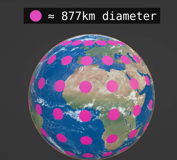
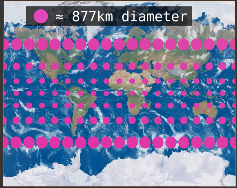
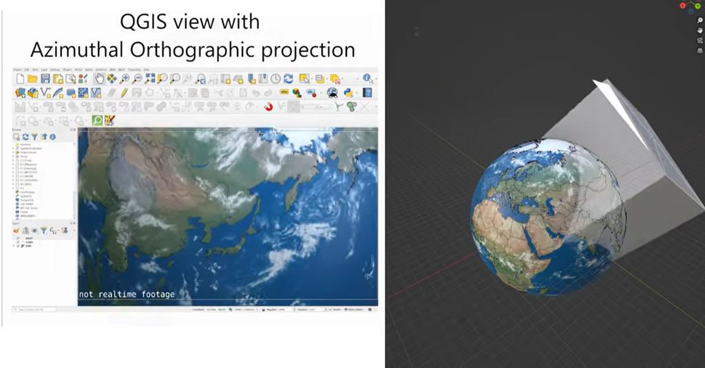
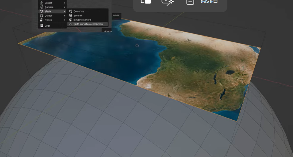
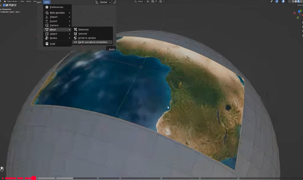
以下將以台灣高屏溪荖濃溪流域的DEM為例嘗試修改將mector projection 改成Azimuthal Orthographic Projection,其他地區也可依例修改,將其放入blenderGIS中,就可以得到accurate 距離和面積。
如何從Qgis中重新設定新的Azimuthal Orthographic Projection
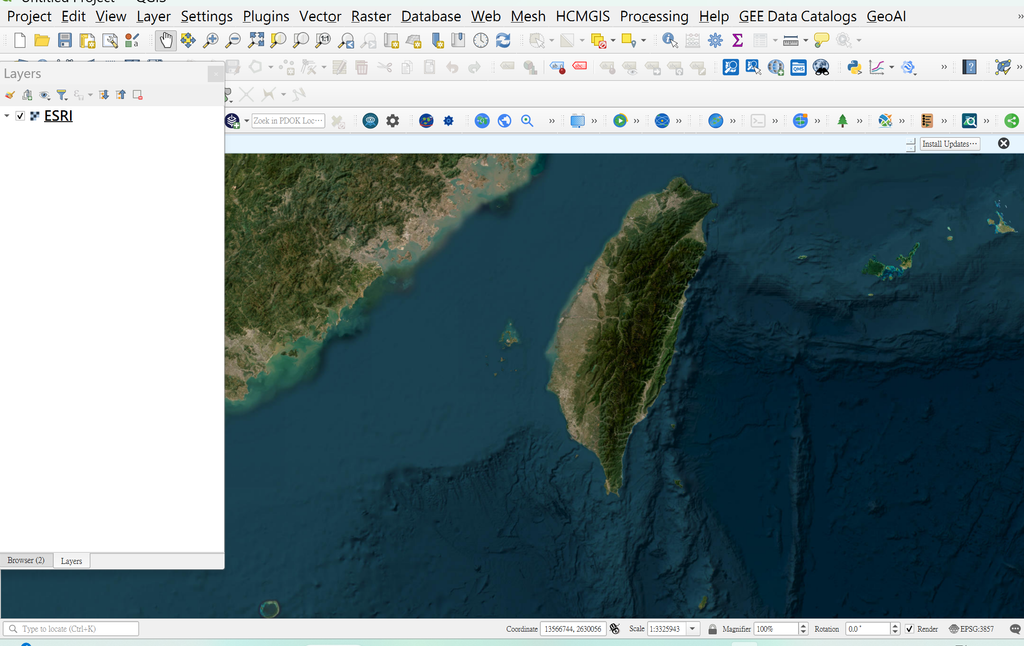
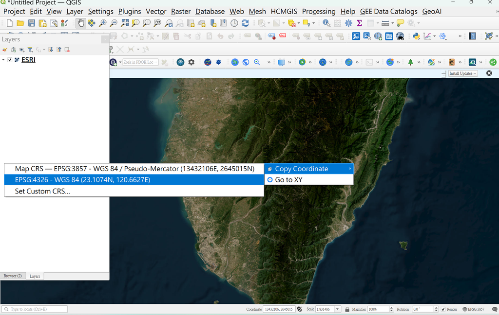
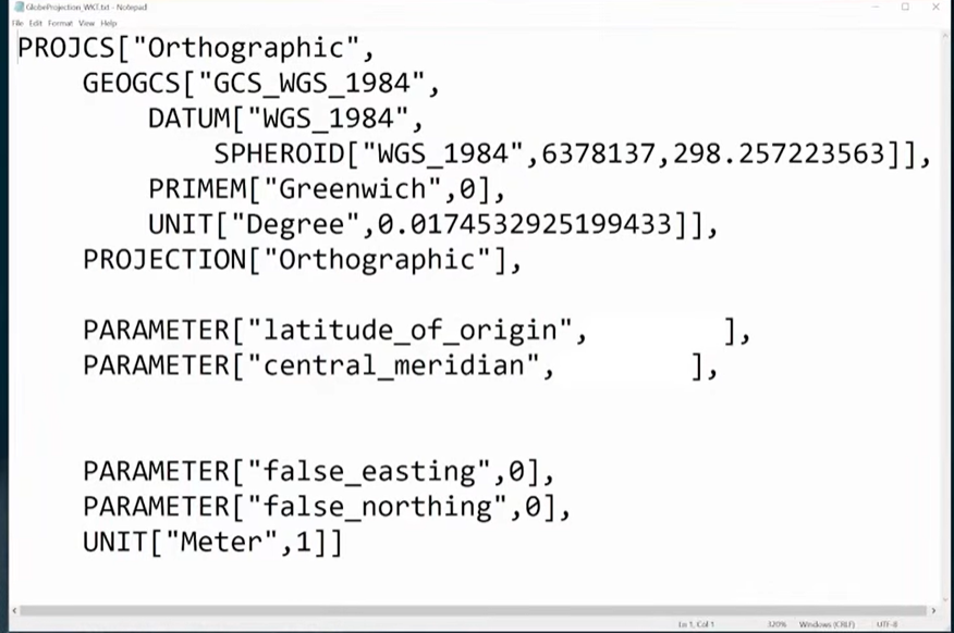
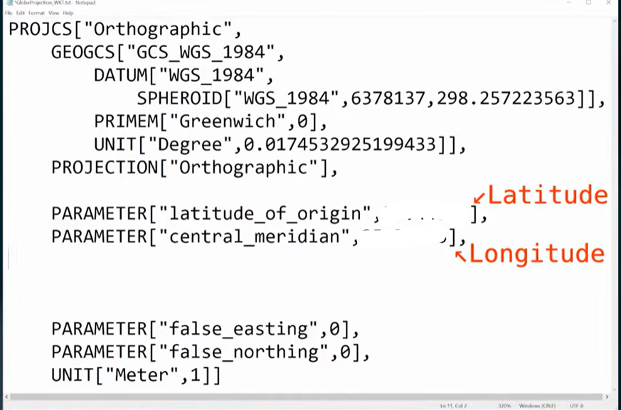
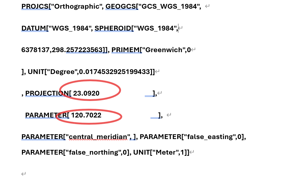
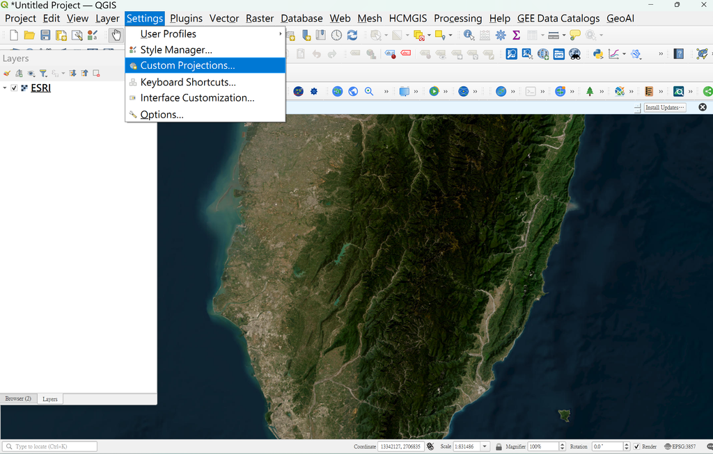
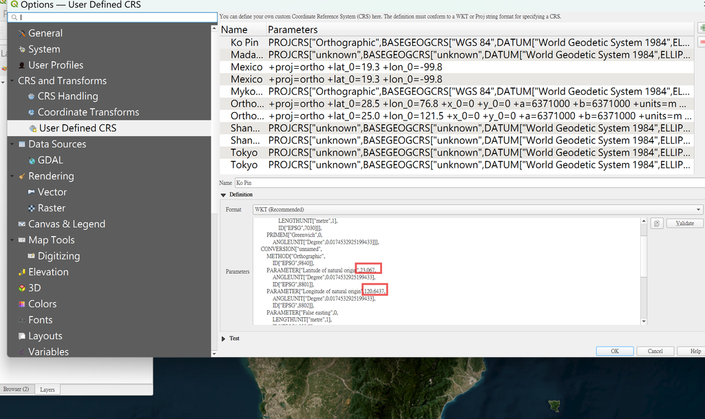
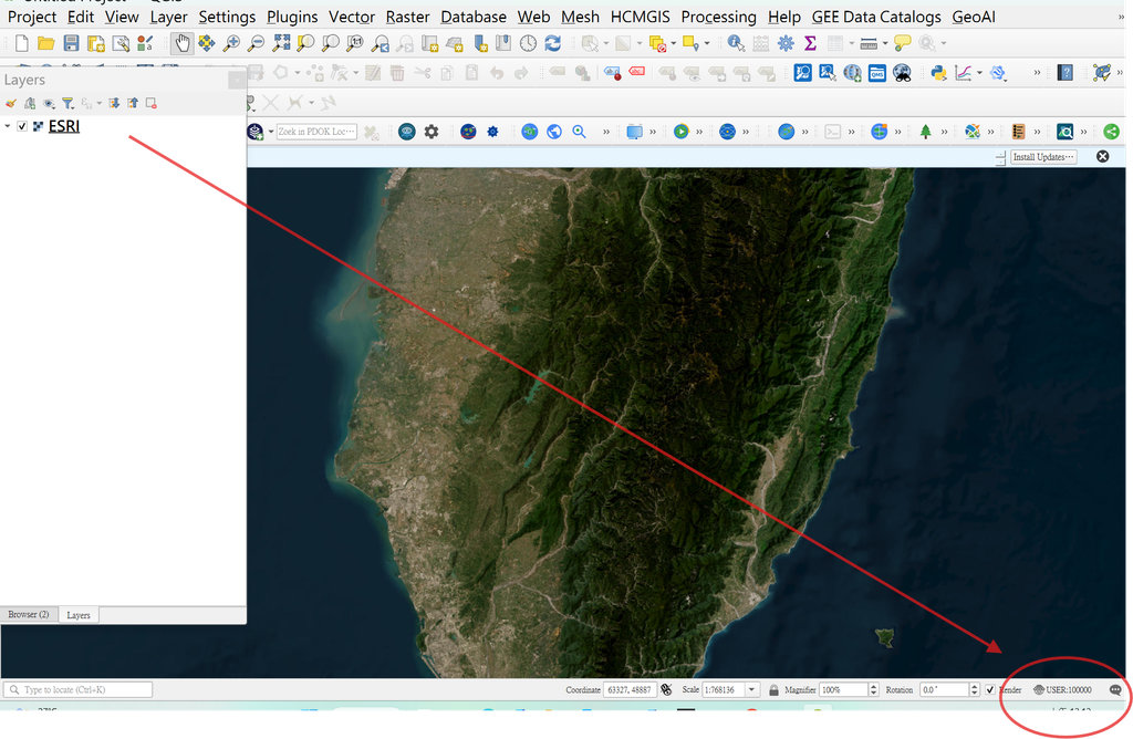
1.在QGIS中輸入底圖ESRI衛星地圖,在工具列中settings中的customs Projection重新定義Projection,先找尋中心點座標,選擇CRS4326的經緯度,複製貼入表格,再整體複製貼入自訂的Projection,投影Ko Pin ,EPSG:100000。
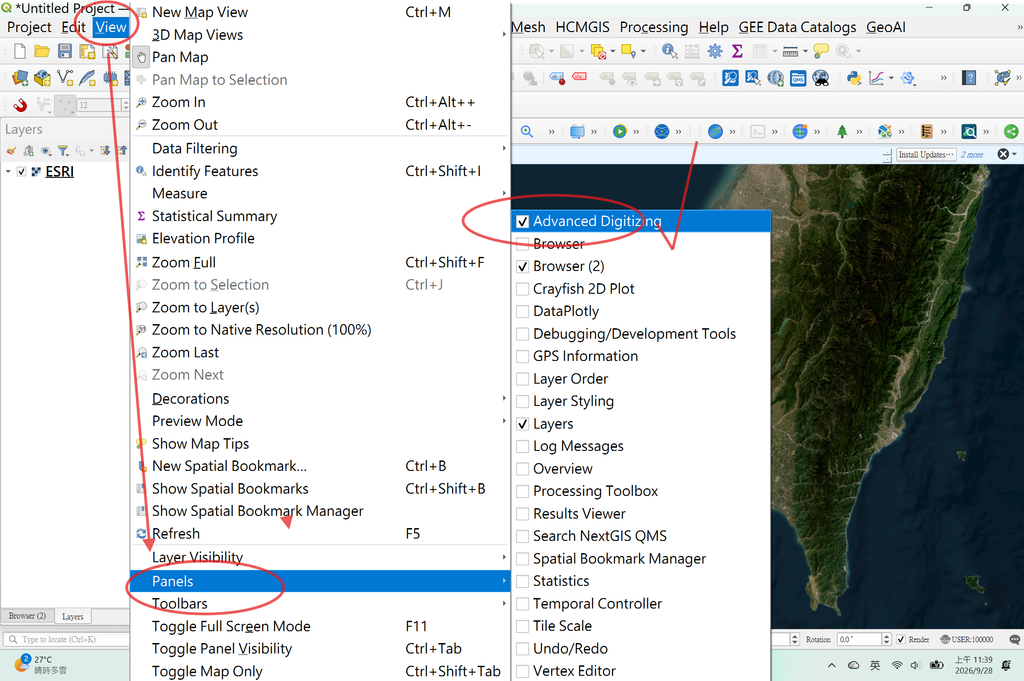
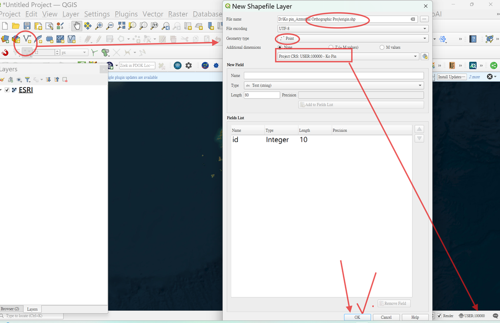
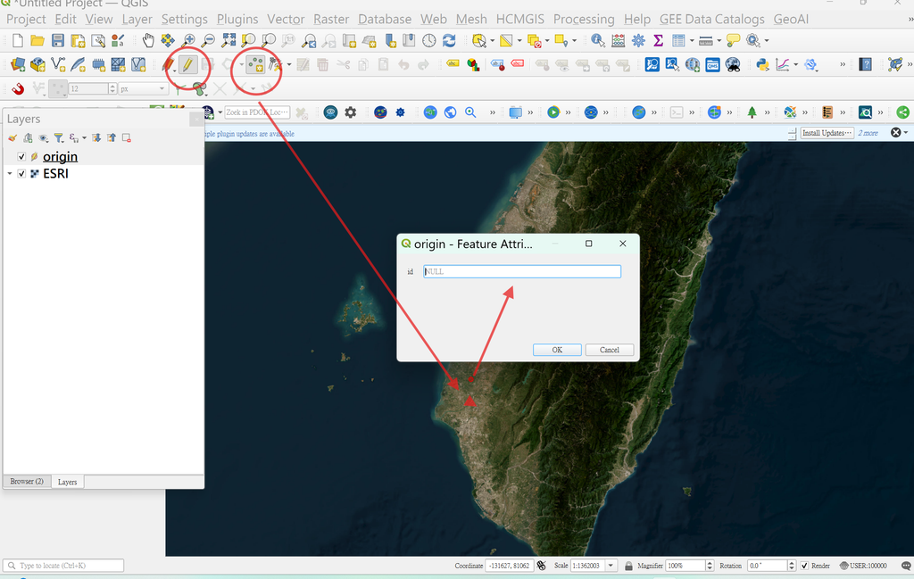
2.making the origin在QGIS中建立中心點,view中打開panel,勾選 advanced Digitizing
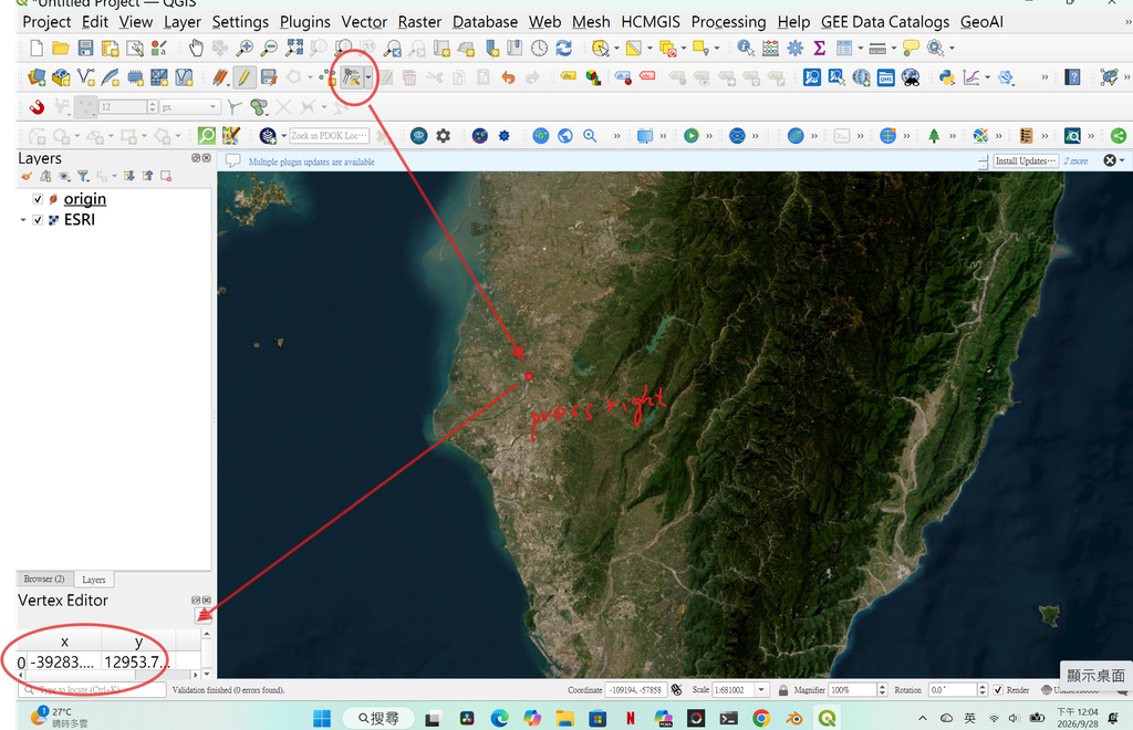
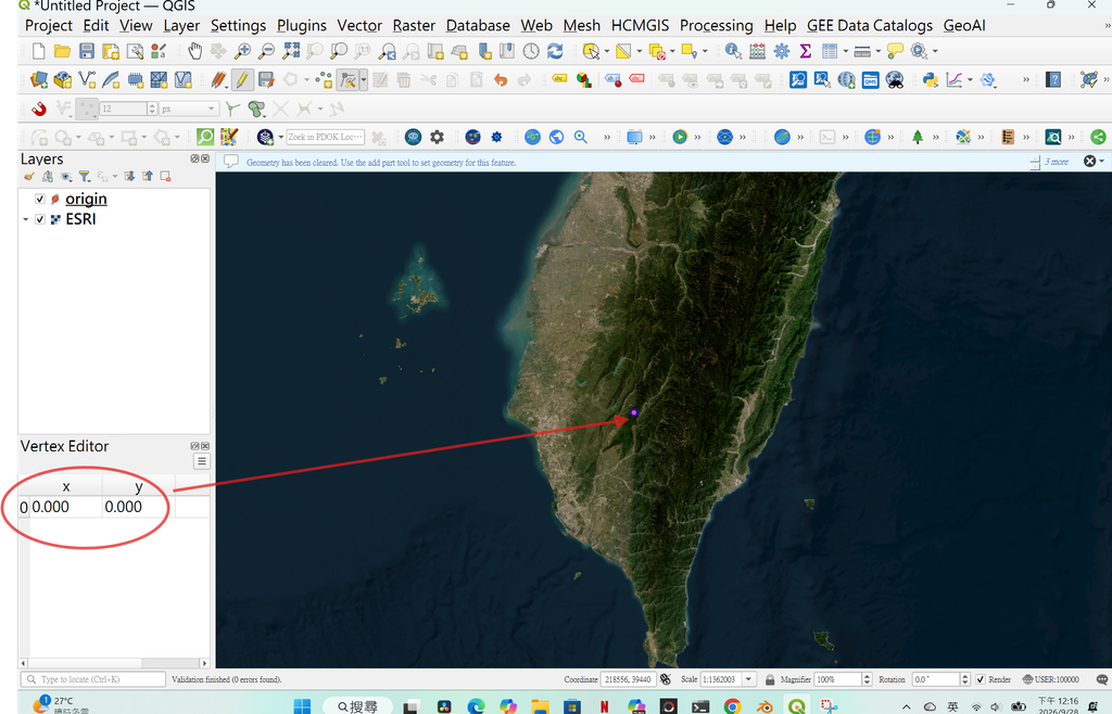
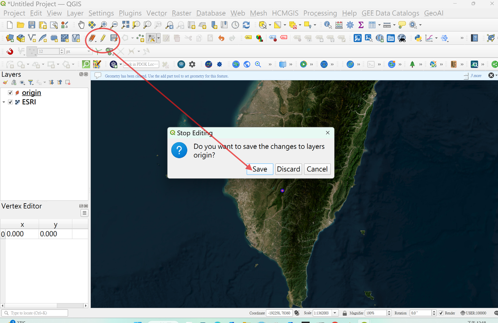
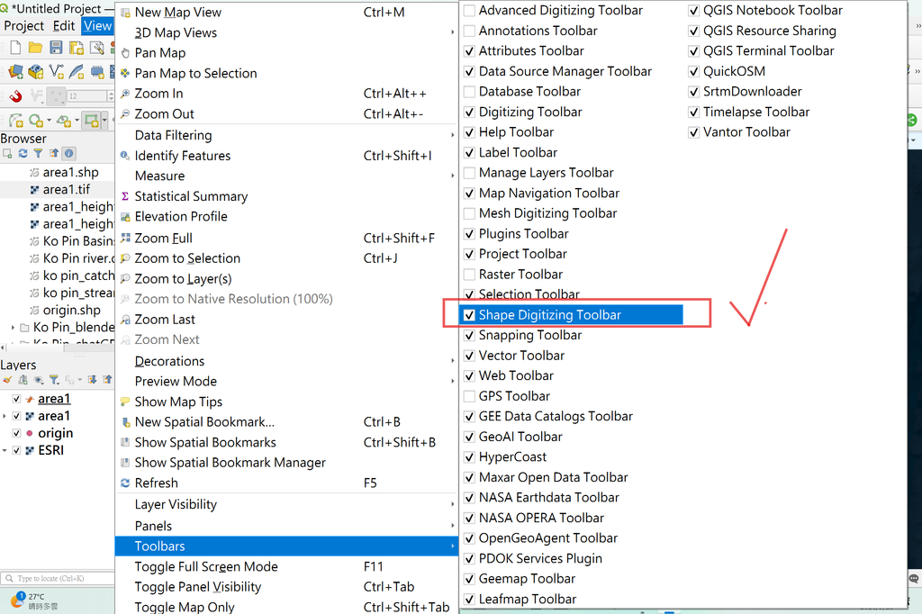
3.define an area定義一個地區
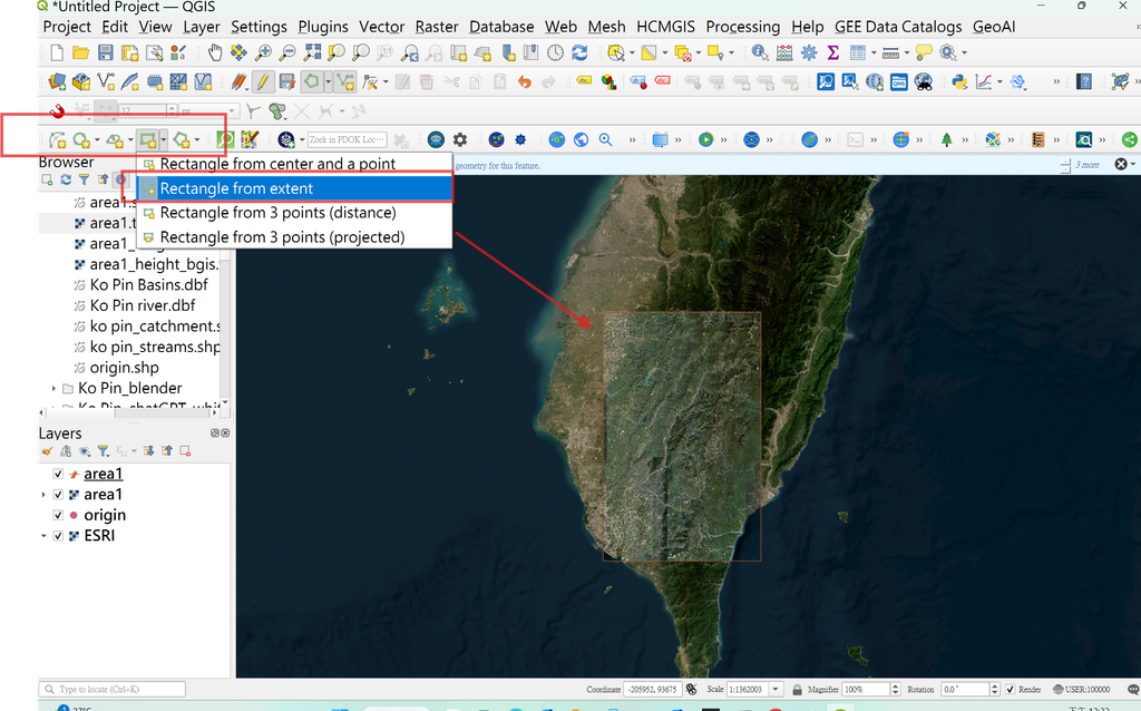
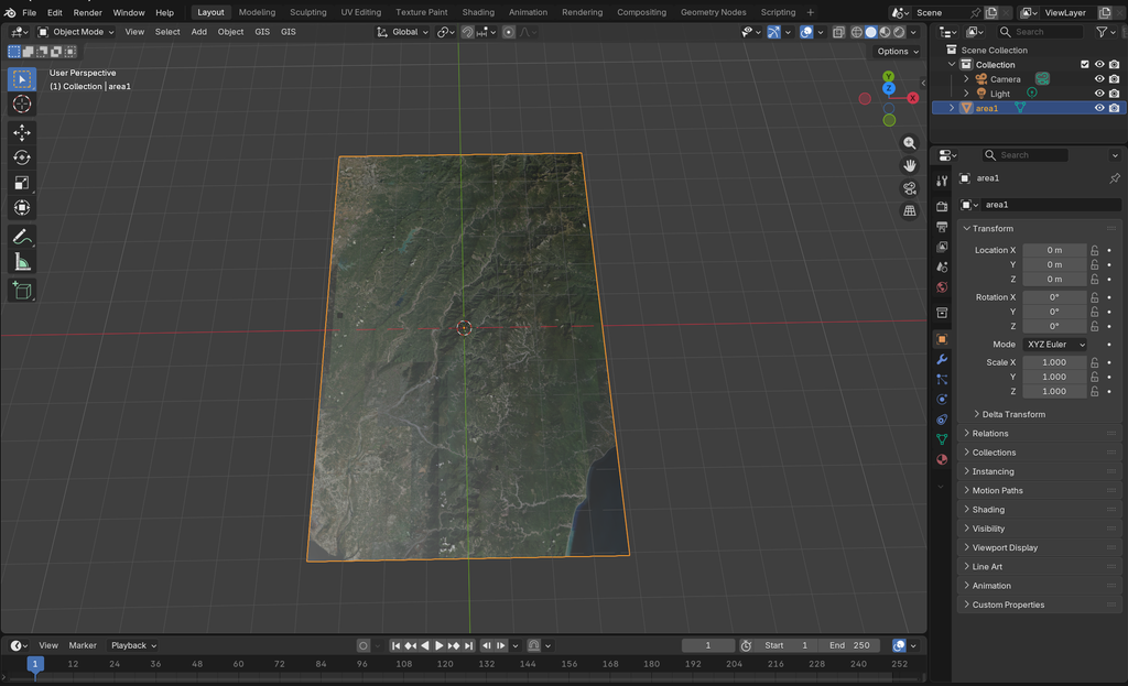
4.import the map to blender輸入地圖至blender5.1
必須將ESRI輸出,切割下area1的範圍
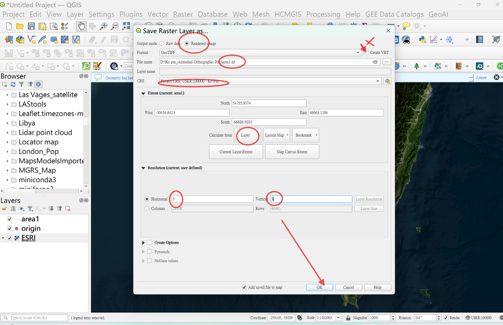
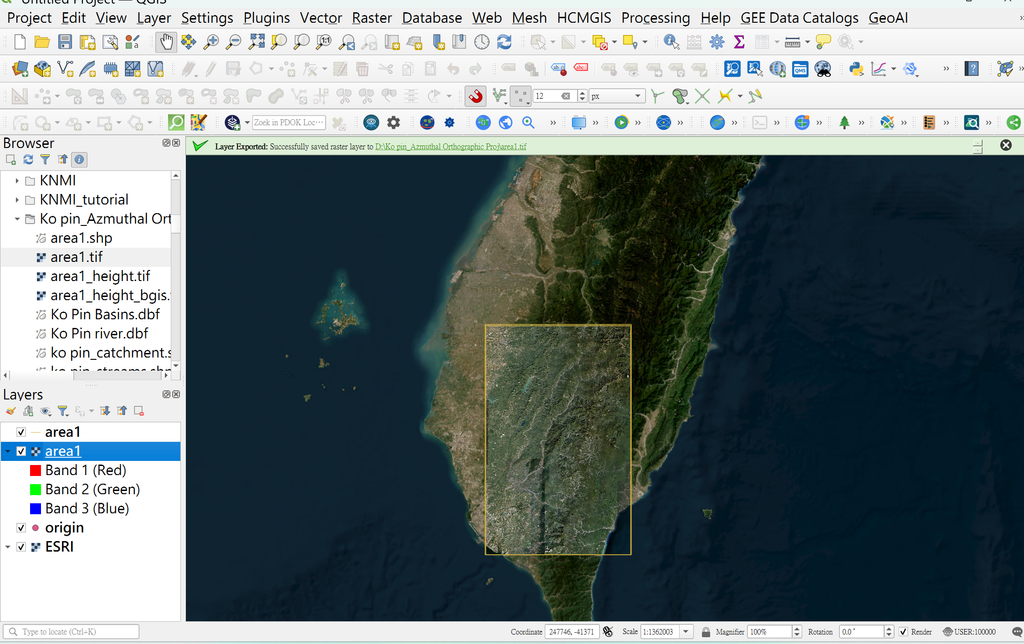
5.getting the height map擷取高程地圖
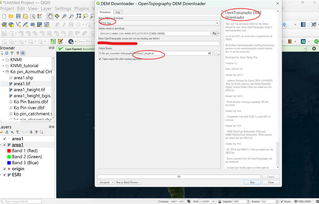
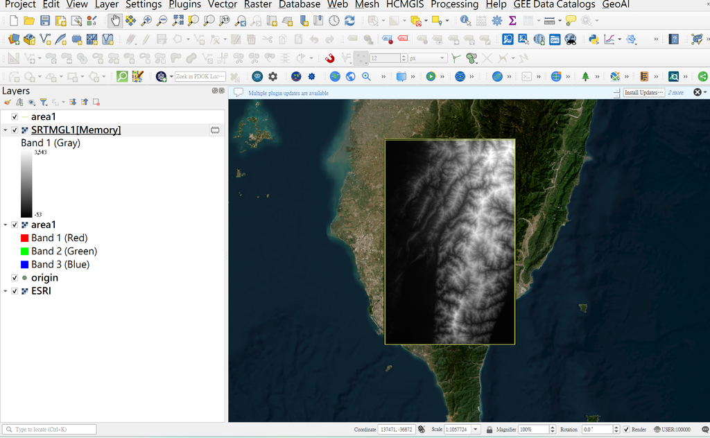
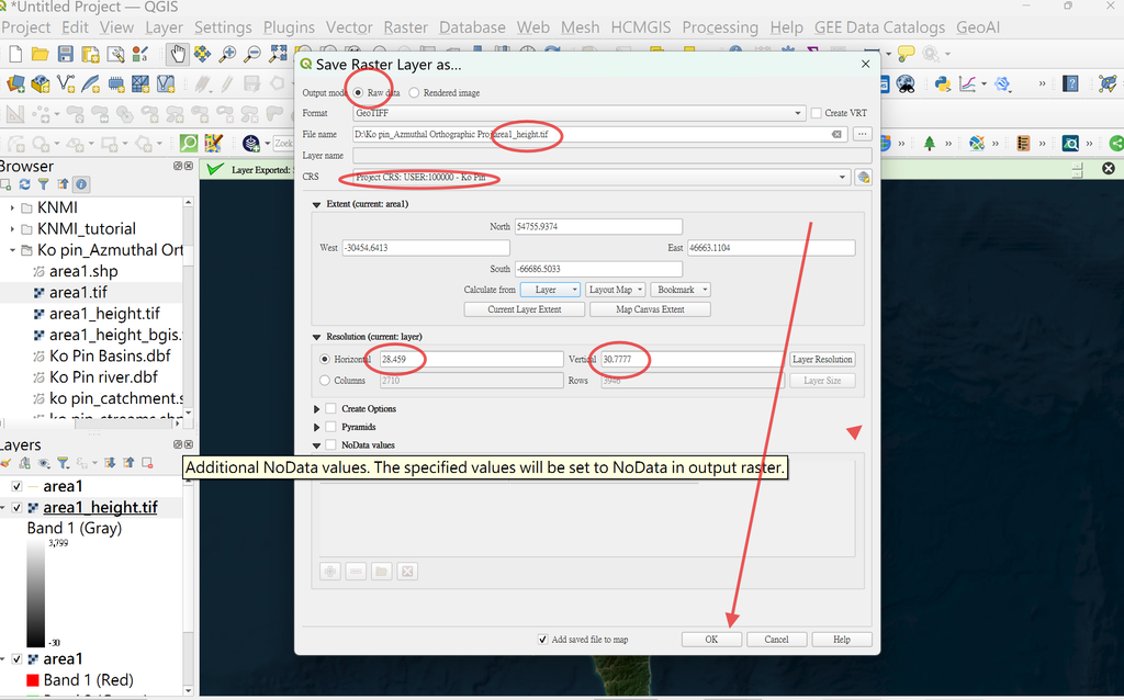
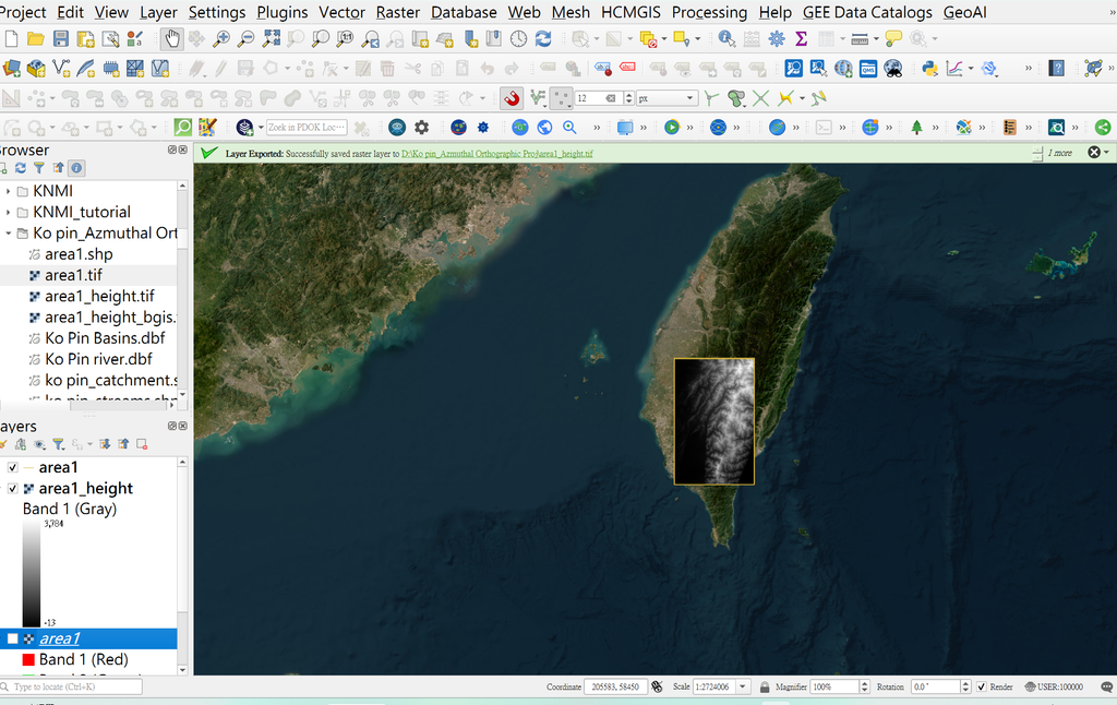
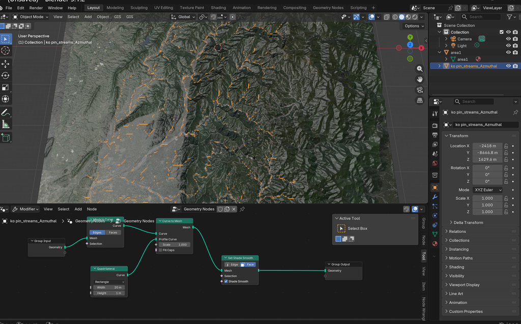
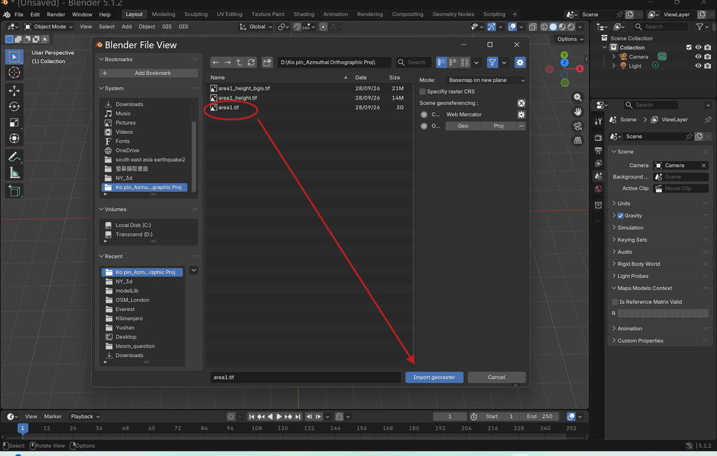
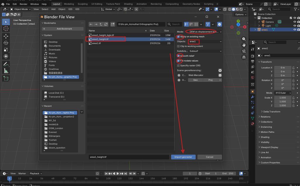
6.將area1與area1_height分別輸入blender5.1
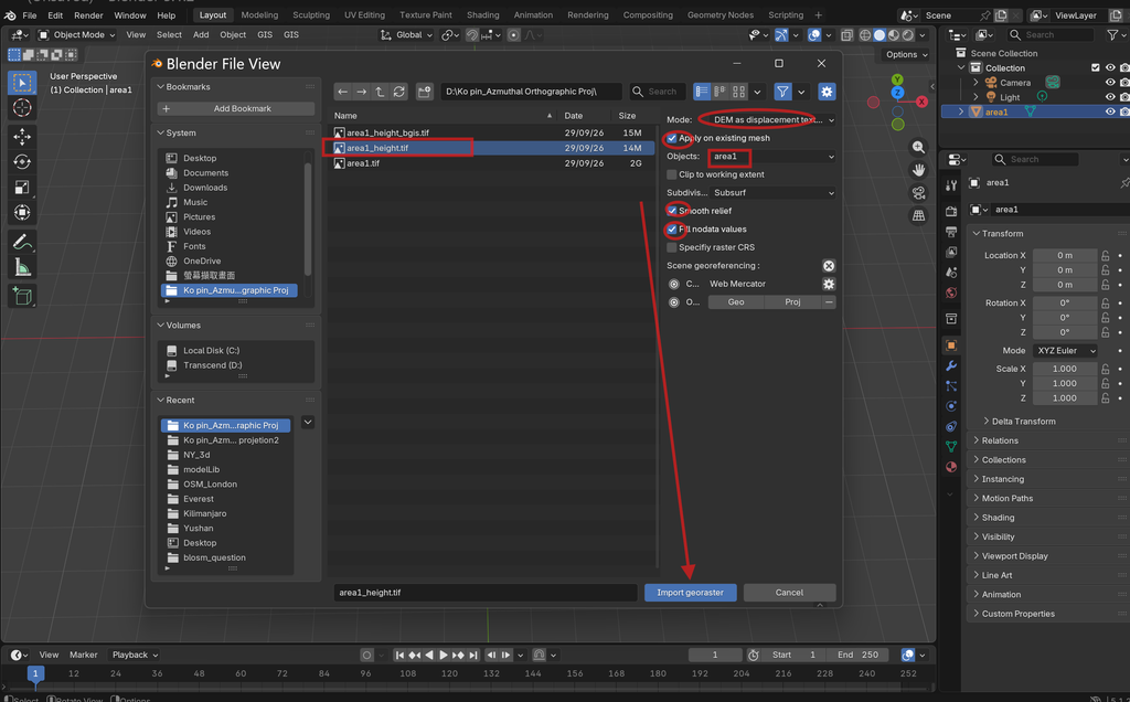
7.立體地形呈現,若高程要顯示稍高,可按修改器,將level 6改成10,可以調高高程。
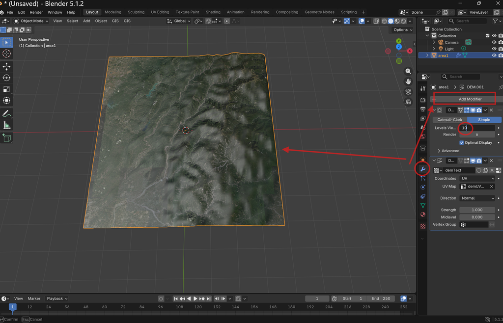
8.完成後的地形,面積,距離是準確的。
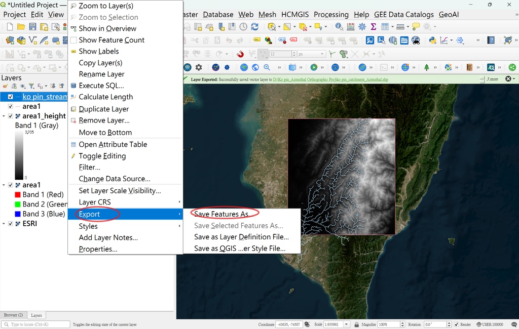
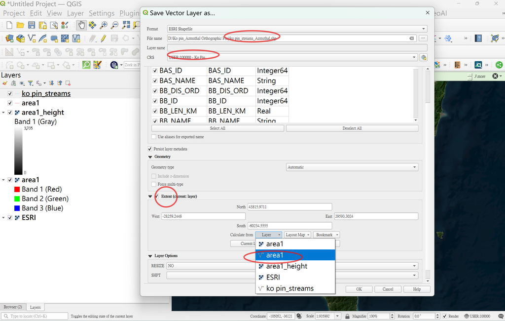
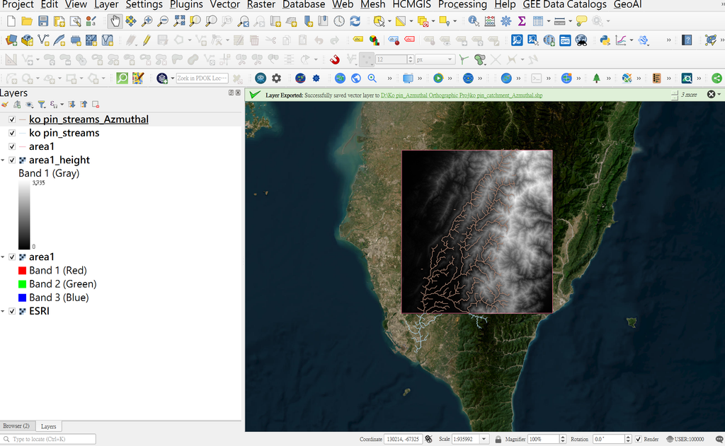
9.將Ko Pin streams重新輸出切割出area1範圍,同時更改CSR為100000
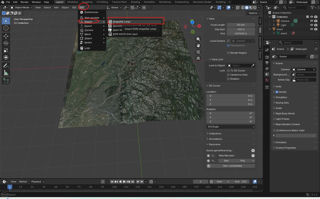
8.blender中import Ko Pin_streams_Azmuthal
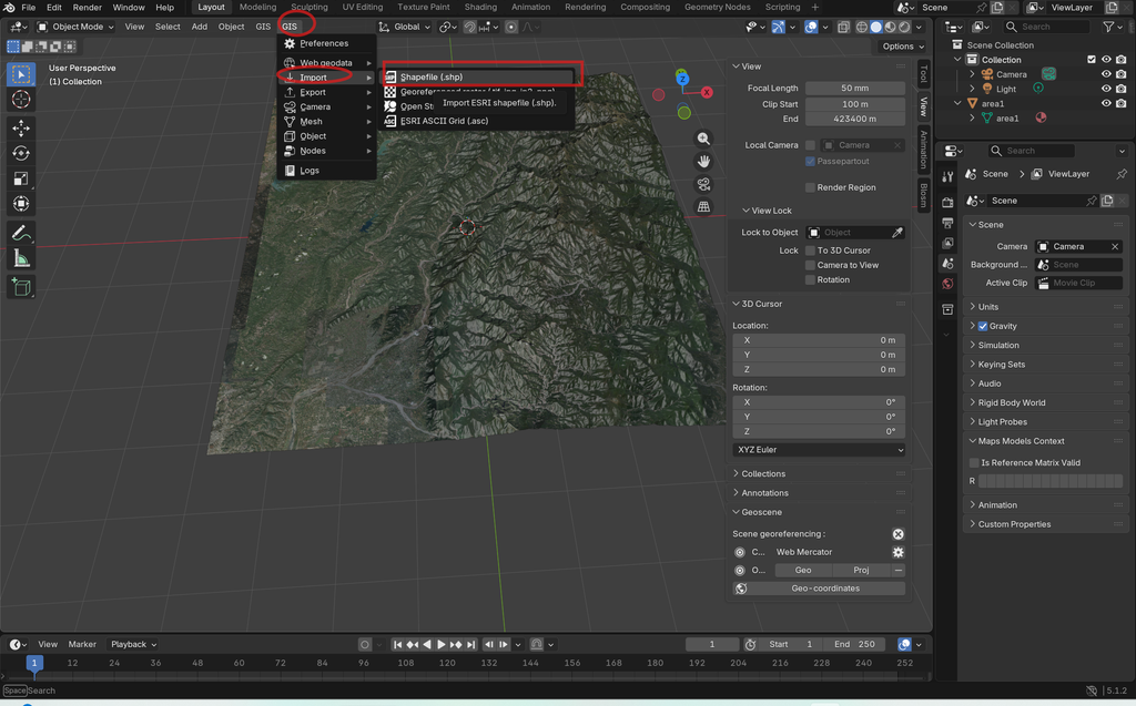
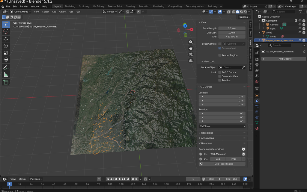
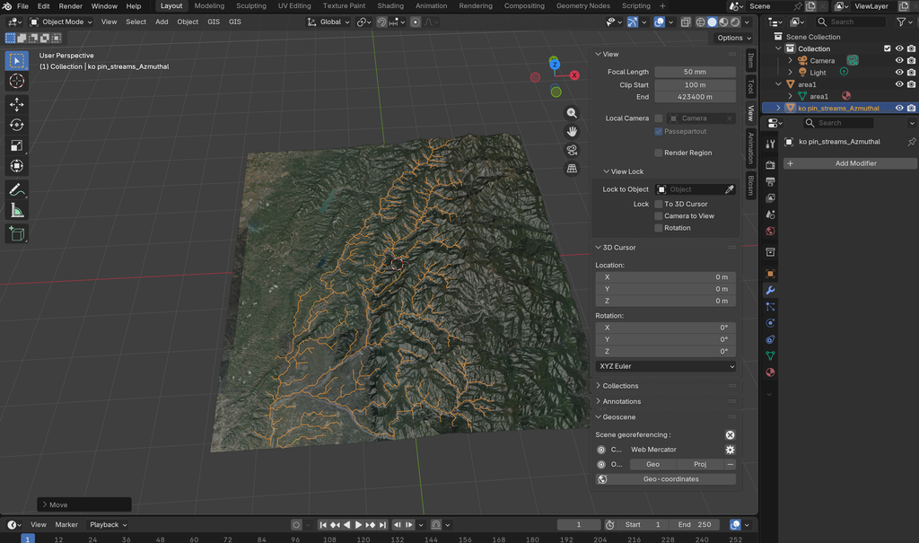
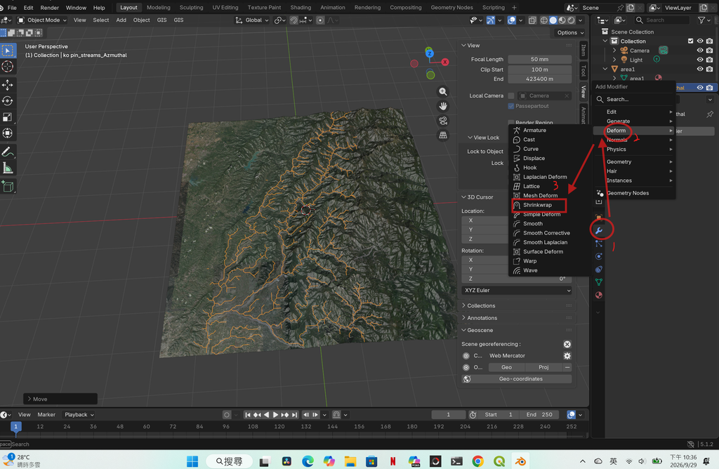
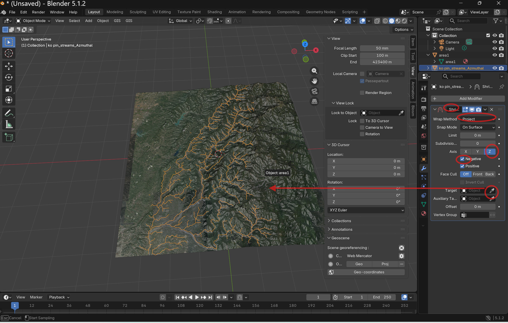
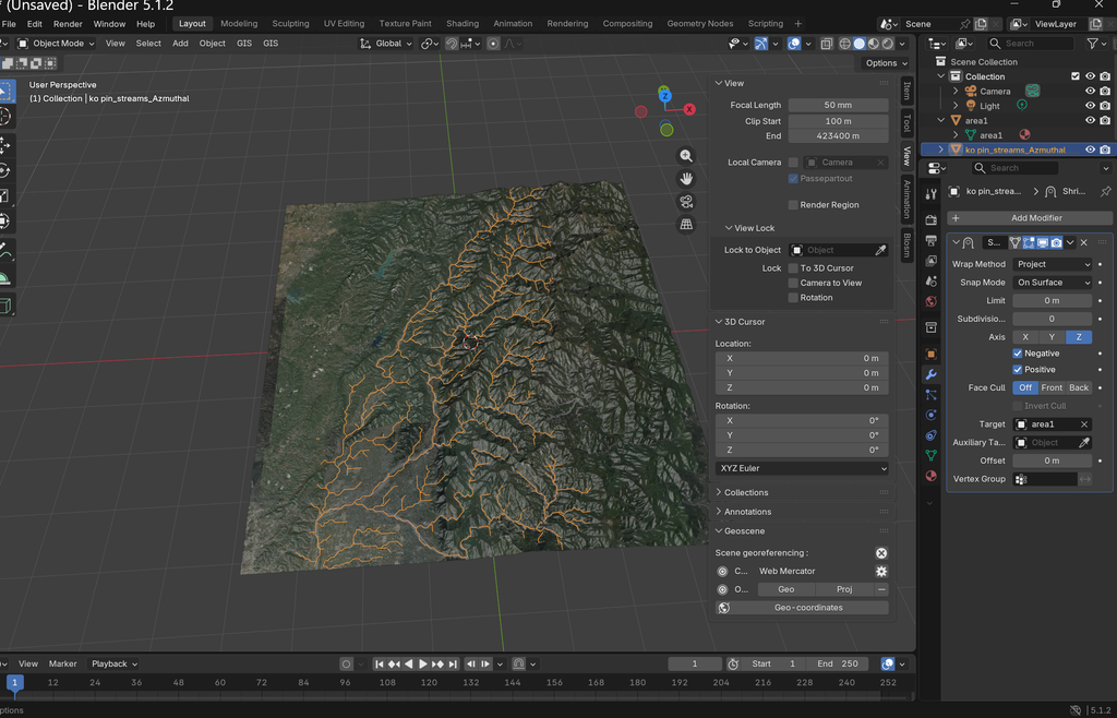
streams沉在底層,必須按G,沿Z軸上升,從修改器中選擇
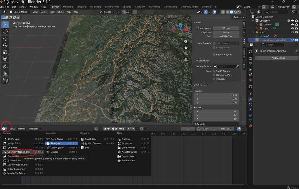
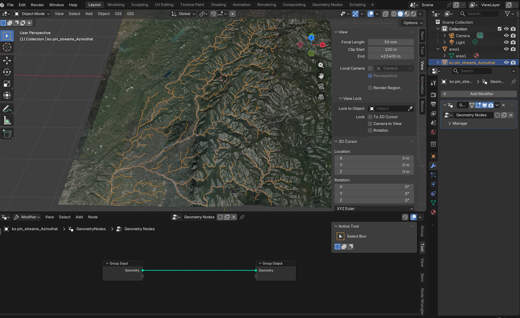
9.修改河川寬窄