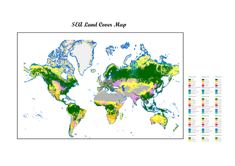
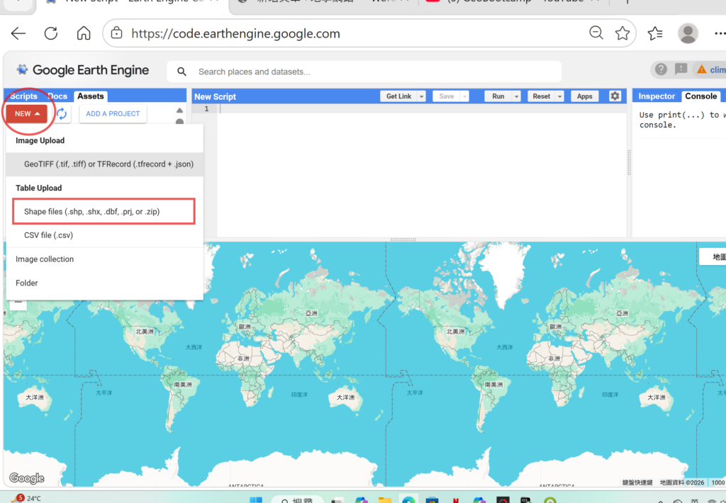
Google Earth Engine import World countries shapefiles 以世界國家為例
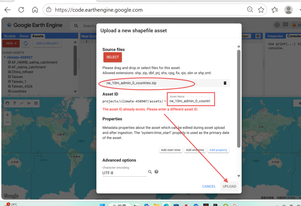
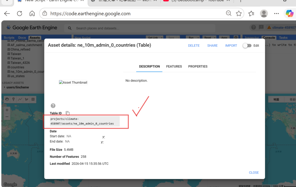
由Nature Earth Package中選取10m解析度的全球行政區界線壓縮檔ne_10m_admin_0_countries.zip直接導入google earth engine Assets:
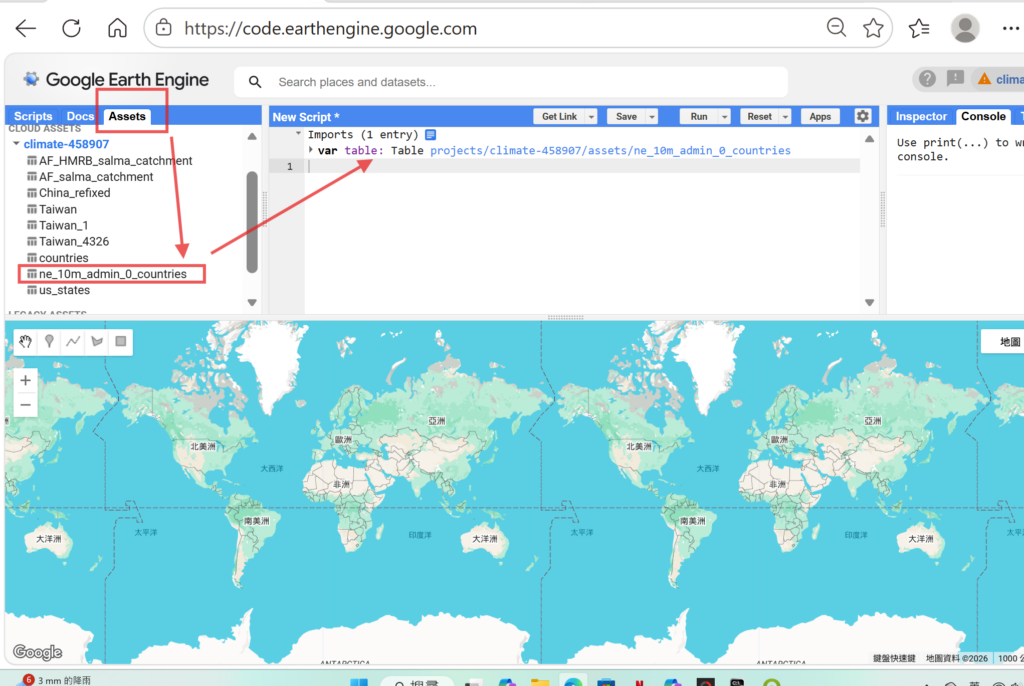
將Asset改成script:
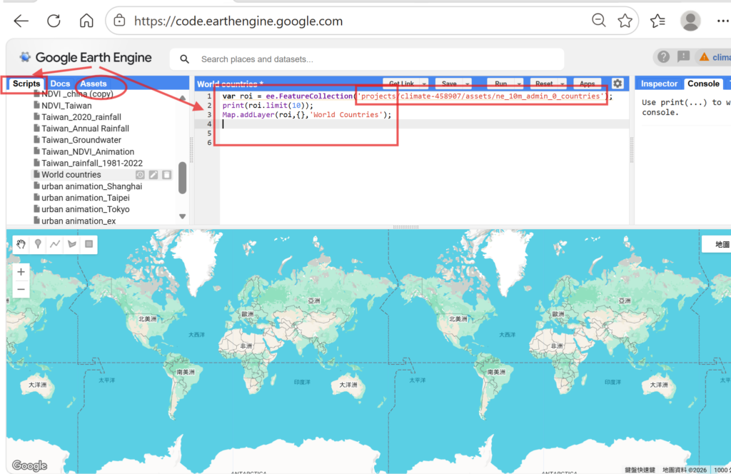
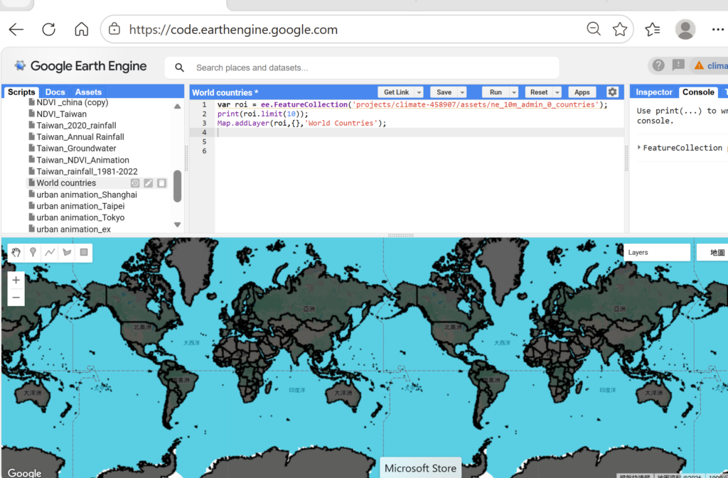
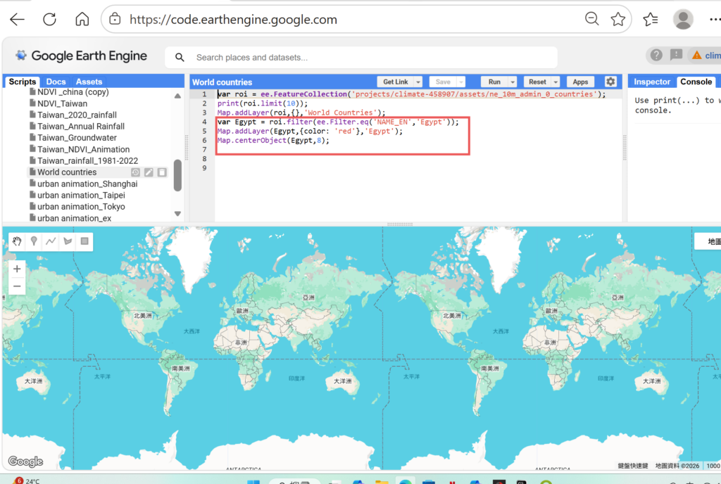
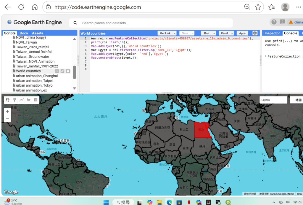
完成全球國家行政區圖,屬於featurecollections檔案格式,若要選取其中一國只要利用filer功能修改即可選取;
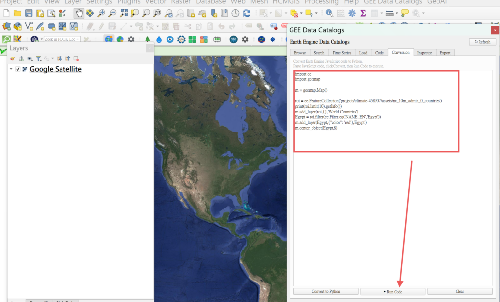
javascript轉換成python
將javascript code 複製貼入Qgis app Gee Data Catalogs,再conversion
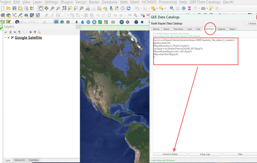
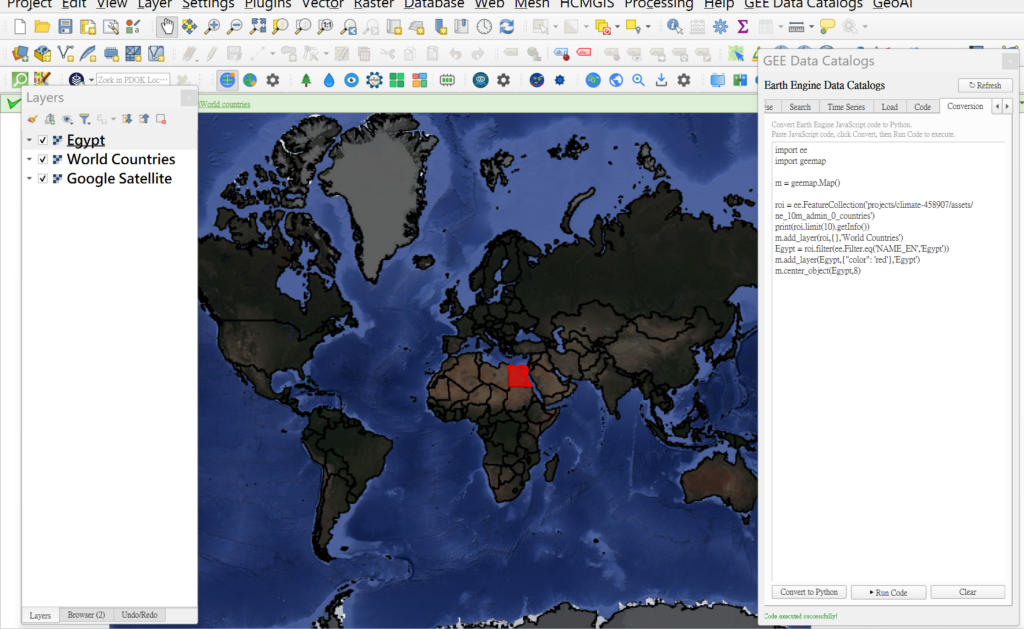
Shapefile檔案轉成javascript 的featurecollection,再轉成python 在QGIS中呈現featurecollections。