以非洲Stampriet使用interpolate分析地下水為例
Interpolate先下載Stampriet地下水井Data資料,轉輸出建立geopackage檔案格式,同時設定當地座標系統CRS:32734。


打開屬性表,將欄位NO3_mg_l中-9999的地區資料移除:


去除1012組無用資料:重新輸出新檔案:

先使用raster工具nearest neighbor分析:


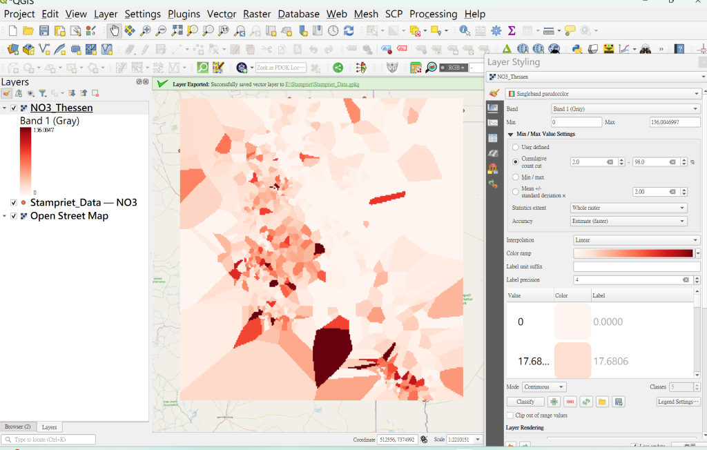
另採用IWD分析:


可從processing選gdal的IDW重繪:


Smart Map 的Kriging分析
首先必須在plungin中下載smart map:

儲存project後,打開SmartMap:


inverse Colar ramp


將IDW畫出等高線:copy複製IDW放於上層:

也可利用raster工具中extration繪製10m等高線:

同時建立Z標籤:

最終完成三種interpolate。